|
|
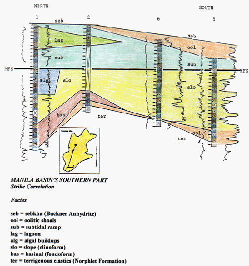
FIGURE 8. Stratigraphic cross-section of the Manila basin's southern part. The correlation is intended to be an approximate strike section. Maximum-flooding surface (MFS) is the datum. Well-logs responses are spontaneous potential (left) and neutron-density (right). Names and locations of wells 1, 2, 5, and 6 are listed in Table 3. Correlation modified from King and Moore (1992). Each mark on the well log represents 10 ft. Well spacing is as follows: well 1 to 2 = 8.4 mi; well 2 to 6 = 27.1 mi; and well 6 to 5 = 7.7 mi. |